
If you are planning a trip to takayna / Tarkine in north-west Tasmania, the best time to visit the Tarkine depends on how you balance weather, crowds, road conditions, and costs. For most travellers, March to April or November offers the best overall compromise. Summer delivers the warmest days with peak holiday demand, while winter provides uncrowded solitude alongside the wettest tracks.
Quick Answer
For most travellers, the best time to visit the Tarkine is March to April or November. These shoulder months combine comfortable walking temperatures, manageable rainfall, and longer daylight with fewer holiday crowds. Summer offers warmer days but heavier bookings, while winter suits visitors prioritising solitude, rushing waterfalls, and moody rainforest atmosphere over dry conditions.
Last checked: 30 September 2026. Dates and figures were verified against official sources.
Key Takeaways
- Best overall: March, April, and November balance mild daytime temperatures with lower visitor demand across regional trails.
- Warmest and driest: December to February brings maximum daylight and daytime highs around 18–21°C (64–70°F), alongside peak holiday bookings.
- Quietest period: June to August delivers solitude, mossy scenery, and flowing waterfalls, though it is the coldest and wettest season.
- Autumn highlights: Rich fungi displays, misty rainforest walks, and soft lighting make April and May a favourite for photographers.
- Access and passes: Standard 2WD cars handle main transit routes between Corinna and Marrawah, but rugged coastal tracks require high-clearance 4WD vehicles and driver passes.
Best Time to Visit the Tarkine: Seasonal Comparison
The best overall time to visit the Tarkine is during the shoulder months of March to April or November. These periods deliver comfortable temperatures for bushwalking, reliable road conditions, and far lighter crowds than peak summer. Summer brings the warmest days, while winter offers misty solitude alongside heavy rain.
takayna / Tarkine covers a vast expanse of north-west Tasmania, so local conditions vary across coastline, river valleys, and elevated inland ranges. The long-term figures below use Bureau of Meteorology observations from Marrawah, near the northern Tarkine, as a practical reference point. Elevated inland areas such as Waratah run colder and experience higher rainfall.
| Season | Typical Marrawah Daytime High | Rainfall Pattern | Best For |
|---|---|---|---|
| Summer Dec–Feb |
About 18–21°C (64–70°F) | Relatively driest part of the year, though rain remains common | Long days, scenic drives, bushwalking, first-time visits |
| Autumn Mar–May |
About 15–20°C (59–67°F) | Moderate rainfall, increasing markedly toward late May | Forest walks, macro fungi photography, lighter crowds |
| Winter Jun–Aug |
About 12–13°C (54–55°F) | Wettest months with frequent squalls and high river flows | Deep solitude, roaring waterfalls, moody wilderness scenes |
| Spring Sep–Nov |
About 14–17°C (57–63°F) | Wet and windy early on, tapering to milder conditions by November | Canopy regrowth, flowering understorey, shoulder touring |
Note: Tasmania’s weather changes rapidly due to southern oceanic weather systems. Long-term monthly averages offer a dependable framework for planning, but unexpected cold fronts or heavy downpours can occur in any season.
Understanding the Tarkine’s Climate
takayna / Tarkine contains Australia’s largest tract of cool-temperate rainforest, meaning wet and changeable conditions can strike at any time of year. Coastal temperatures remain relatively moderate year-round, but inland rainforest and elevated areas run considerably cooler and receive heavier rainfall. Always pack dependable wet-weather gear regardless of what season you visit.
According to Discover Tasmania, this wilderness encompasses dense rainforest, buttongrass moorland, wild beaches, and expansive river systems. The interaction of prevailing westerly winds from the Southern Ocean with rugged terrain creates dynamic local microclimates.
Summer in the Tarkine: Warmest and Relatively Driest
Summer runs from December to February and offers the warmest temperatures alongside the longest daylight of the year. Typical daytime highs in the northern Tarkine sit between 18°C and 21°C (64°F to 70°F), making it the most comfortable window for hiking and coastal drives. However, higher visitor numbers and holiday traffic mean advance booking is essential.
Bureau of Meteorology climate data recorded at Marrawah shows average daytime maximums of 18.4°C in December, 20.3°C in January, and 20.9°C in February. Rainfall is at its annual low, averaging 44 to 46 mm per month during January and February.
Summer advantages:
- Extended daylight: Up to 15 hours of light allows ambitious itineraries covering both coastal routes and inland tracks.
- Comfortable walking temperatures: Mild daytime warmth suits exposed coastal walking and paddling.
- Lowest rain frequency: January and February record fewer wet days than any other period.
- Accessible touring: Forest roads and unsealed surfaces dry out more reliably between showers.
Summer trade-offs:
- Holiday congestion: Late December and January bring high accommodation occupancy and busier vehicle rental fleets.
- Biting insects: March flies and mosquitoes thrive in warm, damp river corridors and forest gullies.
- Bushfire awareness: Hot, dry spells increase regional fire risks, requiring regular safety monitoring.
Warning: Before setting out into remote forest or coastal zones, check the latest Tasmania Fire Service fire danger information alongside current weather forecasts. Bushfire risks can trigger road closures and park alerts at very short notice during hot or windy summer days.
Autumn in the Tarkine: Mild Conditions and Fungi
Autumn spans March to May and is widely regarded as the most atmospheric season to explore the rainforest. Temperatures remain pleasant through March before cooling toward May, accompanied by richer autumn mist and running waterfalls. It is prime time for macro photography, as vibrant fungi sprout across damp mossy tracks like Philosopher Falls.
At Marrawah, daytime maximum temperatures average 19.5°C in March, 16.9°C in April, and 14.7°C in May. Rainfall increases noticeably as the season develops, averaging 65.6 mm in March and rising toward winter levels by late May.
While highland regions such as Cradle Mountain showcase golden displays of deciduous beech (fagus), the Tarkine rainforest is predominantly evergreen. Myrtle beech, sassafras, leatherwood, and celery top pine dominate the canopy. The primary visual rewards of autumn here are the incredible variety of fungi species, damp river mosses, and soft canopy light.
Autumn advantages:
- Optimal hiking conditions: March and April provide crisp air without the winter chill or summer heat.
- Fewer travellers: Crowd numbers ease noticeably once school terms resume in February.
- Macro photography: Cool, damp conditions encourage diverse fungi fruiting bodies along shaded tracks.
- Reduced insect numbers: Cooler autumn nights quickly diminish biting insect activity.
Autumn trade-offs:
- Escalating rainfall: Late May brings regular frontal systems and muddy trail conditions.
- Shorter daylight hours: Daily touring windows narrow, requiring earlier starts for remote drives.
- Chilly evenings: Overnight temperatures drop quickly, requiring thermal base layers for camping.
Winter in the Tarkine: Wet, Cool, and Quiet
Winter brings the coolest, wettest, and quietest conditions to north-west Tasmania from June to August. Coastal maximum temperatures hover around 12°C to 13°C (54°F to 55°F), while inland rivers and waterfalls run at peak volume. It is the perfect season for solitude and moody photography, provided you prepare for short daylight and muddy tracks.
Rainfall reaches its annual maximum during winter, with Marrawah averaging 121 mm in June, 141 mm in July, and 135 mm in August. Coastal lows average around 7°C (45°F), though inland highland edges can experience frosty mornings and occasional snow dustings.
Winter advantages:
- Absolute solitude: Visitor numbers reach their annual low, leaving campgrounds and tracks largely empty.
- Spectacular waterways: Heavy rainfall fuels rushing rivers, full cascades, and vigorous rainforest waterfalls.
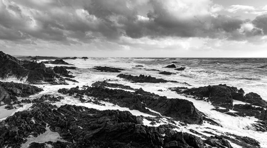
- Dramatic scenery: Rolling sea swells, low-hanging cloud, and forest mist create compelling photography subjects.
- Zero insect hassle: Biting insects are practically non-existent throughout the winter months.
Winter trade-offs:
- Saturated trails: Mud, slippery exposed roots, and standing water make walking tracks challenging.
- Restricted daylight: Days are short, leaving limited time for multi-stop touring routes.
- Unsealed road deterioration: Prolonged rainfall can create ruts, potholes, and slick gravel surfaces.
- Reduced tourism services: Selected regional operators, cafes, and tours run reduced winter schedules.
Spring in the Tarkine: Longer Days and New Growth
Spring runs from September to November, bringing lengthening days and fresh green growth to the forest canopy. Early spring remains quite cool and damp, but conditions warm significantly by November with average highs reaching 17°C (63°F). November stands out as an exceptional shoulder-season month with mild weather and few crowds.
Marrawah’s average daytime temperatures climb from 13.8°C in September to 15.1°C in October and 16.7°C in November. Rainfall averages taper from 104.8 mm in September down to 68 mm in November.
Spring advantages:
- Vibrant forest renewal: Pale new fronds emerge on tree ferns and regional wildflowers begin blooming.
- Expanding daylight: Increasing hours of light allow flexible touring itineraries.
- Favourable late-spring weather: November combines warm afternoons with manageable trail conditions.
- Pre-summer calm: Major tourist attractions and campsites remain peaceful before December holidays.
Spring trade-offs:
- Unpredictable weather: Rapid transitions from bright sunshine to squally rain occur frequently.
- Lingering ground moisture: Tracks and secondary dirt roads take time to dry out from winter saturation.
- Awakening insects: Warmer spring afternoons bring the return of mosquitoes and sandflies.
If you enjoy exploring how weather patterns dictate wilderness travel across distinct environments, you can compare these dynamics with our guide to the Best Time to Visit Kurtalan, Siirt: Weather, Crowds, and Costs.
When to Visit the Tarkine for Fewer Crowds
To avoid crowds in the Tarkine, plan your trip for March, April, or November. These shoulder months avoid the heavy domestic traffic of the Australian summer holidays while keeping tracks and services easily accessible. For complete solitude, visit between June and August when traveller numbers drop to their annual low.
Relatively Busier Periods
- Late December through January: Tasmania’s summer holiday season brings high domestic visitation, booking out premium coastal and rainforest lodging weeks ahead.
- Easter long weekend: A very popular four-day holiday period where family camping and regional road trips peak.
- Tasmanian school holidays: April, July, and late September to October school breaks generate localized surges at popular short walks and picnic reserves.
Best Shoulder-Season Periods
- March: Delivers late-summer warmth without the school holiday crowds, making it an ideal touring month.
- April: Quieter trails, crisp walking weather, and rich forest photography opportunities.
- November: Longer spring daylight and climbing temperatures right before the Christmas rush.
Quietest Time
June through August represents the true off-peak season. You will encounter few other travellers on the road or walking tracks, though you must accept wet weather, cold evenings, and early sunsets.
How Much Does a Tarkine Trip Cost?
Visiting the Tarkine is generally affordable because general entry to the regional reserves is free. Your major expenses will be vehicle hire, fuel, accommodation, and optional river cruises or camping permits. Costs rise during peak summer holidays and Easter, while winter and midweek shoulder travel yield the best value.
Park and Camping Fees
You do not need a Tasmania Parks Pass simply to drive through the Tarkine or enter the Arthur-Pieman Conservation Area. However, camping fees apply across designated campgrounds, and specialised 4WD tracks require an off-road permit.
As of late 2026, the Tasmania Parks & Wildlife Service lists Arthur River campground sites (Peppermint and Manuka) at A$15 per night for two people (A$5 per additional adult), with rates scheduled to adjust to A$18 per night from 1 November 2026. Designated self-contained bush campgrounds (such as Prickly Wattle, Nelson Bay, and Camp Elsewhere) are A$6 per night for two people (A$3 per additional adult) through 31 October 2026, transitioning to A$18 per night on 1 November 2026. Bookings are made on arrival at the Arthur River Visitor Centre or 24-hour self-registration stations. Always confirm the latest rates on the official Arthur-Pieman camping page before your departure.
Accommodation
- Campgrounds: The most economical way to stay, ranging from flush-toilet sites at Arthur River to fully self-sufficient coastal bush sites.
- Regional hotels and cottages: Gateways like Smithton, Stanley, and Waratah offer comfortable motel rooms, self-contained apartments, and historic pubs.
- Corinna Wilderness Village: Nestled deep inside the southern rainforest, Corinna offers eco-retreat cabins directly along the Pieman River.
- Peak pricing: Secure bookings months in advance if travelling between Boxing Day and late January.
Transport
A personal or rental vehicle is mandatory to explore the region effectively. Rental tariffs fluctuate significantly by season, vehicle category, and pickup depot in Hobart, Launceston, or Burnie. Lock in bookings early for summer dates to avoid elevated peak rates.
Fuel requires a realistic budget. Long driving loops on unsealed gravel consume fuel more quickly than highway driving, and service stations are widely spaced.
Food
- Self-catering: Supermarkets in larger towns like Smithton, Wynyard, or Burnie allow you to stock up on groceries at standard retail prices.
- Local cafes: Small cafes and pubs operate in Arthur River, Marrawah, and Waratah, though operating hours can be irregular in winter.
- Emergency rations: Always pack extra food and drinking water in your vehicle to cover unexpected detours or mechanical delays.
Tours and River Cruises
Organised eco-cruises along the Arthur River and the historic MV Arcadia II cruise on the Pieman River from Corinna provide spectacular rainforest access. These experiences require separate tickets and operate seasonal timetables, making advance confirmation sensible.
When Are Costs Usually Higher?
- Christmas to late January peak summer holiday window.
- Easter long weekend and autumn school holidays.
- Last-minute rental car reservations during summer.
When Can You Find Better Value?
- Winter months (June to August) across accommodation and vehicle rentals.
- Midweek shoulder travel during March, April, or November.
- Utilising Parks & Wildlife bush campsites instead of commercial cabins.
Best Time for Tarkine Activities
The ideal time for Tarkine activities depends heavily on whether your itinerary prioritises hiking, river travel, or photography. Bushwalking peaks in March, April, and November, river cruises run best across the extended daylight of summer, and waterfall photography shines during wet winter months. Planning around your primary pursuit guarantees the best conditions.
Bushwalking and Hiking
Best overall: March, April, and November. These months feature comfortable daytime temperatures that prevent overheating on uphill stretches while keeping track mud manageable.
Summer offers long daylight hours for full-day wilderness hikes, though direct sun can feel harsh on exposed coastal heathland. In winter, boardwalk sections remain walkable, but wilderness trails become heavily boggy.
Kayaking and River Journeys
Paddling conditions on the Pieman and Arthur Rivers depend heavily on local wind and river flow rates. Late spring, summer, and early autumn provide longer daylight hours and calmer water surfaces. Always check weather advisories and water levels before launching private watercraft.
Wildlife Spotting
Tasmanian pademelons, Bennett’s wallabies, wombats, and platypus can be seen throughout the year. Dusk and dawn represent prime viewing hours when native wildlife gathers along forest clearings and roadsides.
The Tasmania Parks & Wildlife Service urges motorists to avoid driving through reserves after dark. Tasmanian devils and quolls frequently feed along road verges, where headlight glare can cause fatal collisions.
Photography
- Summer: Vibrant coastal water tones, long sunset light, and easily accessible lookout points.
- Autumn: Spectacular fungi varieties, low mist drifting through rainforest ferns, and gentle lighting.
- Winter: High river discharges, dramatic storm clouds along the coast, and saturated mossy greenery.
- Spring: Fresh tree fern growth and delicate native blooms along forest borders.
Pro Tip: Pack a dedicated dry bag and waterproof rain sleeve for camera equipment or smartphones even in midsummer. Persistent river spray, coastal sea mist, and sudden canopy drips can saturate electronic gear unexpectedly.
For more insights on planning trips around wet and unpredictable coastal wilderness climates, consult our ultimate guide to visiting Juneau, Alaska.
Getting to and Around the Tarkine
Reaching the Tarkine requires flying into Tasmania and hiring a car, with regional airports providing the closest access points. The region is traversed by scenic road networks combining sealed highways, unsealed gravel roads, and a river cable ferry. Planning your routes, fuel stops, and vehicle type in advance is vital for safe travel.
Flying to Tasmania
Hobart Airport (HBA) and Launceston Airport (LST) provide regular passenger flights from major Australian mainland cities. For visitors focusing entirely on north-west Tasmania, Devonport Airport (DPO) and Burnie Airport at Wynyard (BWT) reduce driving time substantially.
The Burnie Airport is situated immediately adjacent to Wynyard, roughly 19 km west of Burnie, placing you within a 90-minute drive of northern Tarkine attractions.
Driving Times
Travel times vary significantly based on road surface quality and terrain. According to official estimates from Discover Tasmania:
- Hobart to Corinna: Approximately 5 hours (350 km).
- Launceston to Corinna: Approximately 3 hours 30 minutes (250 km).
- Launceston to Arthur River: Approximately 3 hours 30 minutes (290 km).
Always add extra travel time for unsealed road sections, timber trucks, wildlife caution, and variable weather conditions.
Tarkine Drive
The sealed and well-maintained Tarkine Drive circuit loops through the northern sector. It provides standard passenger cars with easy access to premier sites, including the Julius River rainforest walk, the sinkhole at Trowutta Arch, Sumac Lookout, and the dramatic coastline at the Edge of the World.
Western Explorer and 2WD Access
The Western Explorer (C249) links Marrawah and Arthur River in the north with Corinna and Zeehan in the south. This remote, unsealed gravel road is maintained for standard-clearance 2WD vehicles during regular weather conditions, as noted by the Tasmania Parks & Wildlife Service.
However, access roads to remote coastal beaches south of Temma are strictly 4WD-only. Driving south of Temma to Sandy Cape or along the Balfour Track requires an Arthur-Pieman Recreational Driver Pass, an equipped high-clearance 4WD, and recovery gear.
Fatman Barge at Corinna
The vehicle barge across the Pieman River at Corinna is the only operational cable-driven vehicle barge in Tasmania and acts as a vital link for travellers traversing the Western Explorer. The crossing takes approximately three to five minutes, carries vehicles up to 6.0 tonnes, and does not require reservations. Fares are set at A$30 for standard cars, utes, and 4WDs, A$15 for motorcycles or pedestrians, and A$35 for vehicles towing trailers or caravans, payable by cash or card according to Corinna Wilderness Village Fatman barge access. The barge operates daily from 9:00am to 7:00pm during daylight saving months (October to April) and from 9:00am to 5:00pm in winter.
Fuel and Supplies
Smithton is the primary commercial service centre for the northern Tarkine, offering full supermarkets, pharmacies, mechanical services, and fuel stations. Re-fill your fuel tank in Smithton or Wynyard before entering remote country, as fuel is not sold in the Arthur-Pieman Conservation Area and options at Corinna or Marrawah can be limited.
Mobile Reception
Mobile phone reception is patchy or completely absent across large sections of the Western Explorer, Corinna, and the coastal tracks. Download digital offline maps prior to departing regional hubs, carry a physical map, and communicate your daily travel intentions to accommodation hosts or emergency contacts.
What to Pack for the Tarkine
Packing for the Tarkine requires versatile layers designed to handle sudden rain, chilly winds, and shifting temperatures. Even during warm summer afternoons, dense rainforest cover and river breezes can create surprisingly cool microclimates. Waterproof outerwear, sturdy traction footwear, and self-sufficient safety gear are non-negotiable.
- Quality waterproof jacket: A breathable, seam-sealed shell is necessary in every season.
- Insulating fleece or wool mid-layers: Keep you warm when temperatures drop after rain.
- Sturdy waterproof hiking boots: Essential for slippery roots, mud, and uneven boardwalks.
- Moisture-wicking socks: Bring extra pairs to change into after wet forest walks.
- Insect repellent: Essential protection against March flies and mosquitoes in summer.
- Sufficient drinking water: Carry your own supplies; do not rely on untreated park tanks.
- Offline GPS and paper maps: Mobile signal drops out across forest valleys.
- Portable battery power bank: Cold weather drains device batteries quickly during outdoor navigation.
- Compact headlamp: Shaded rainforest canopies darken rapidly well before official sunset.
Warning: The Tasmania Parks & Wildlife Service confirms that treated drinking water is not supplied anywhere within the Arthur-Pieman Conservation Area. Always carry sufficient drinking water for your party and boil or filter any water collected from local natural sources.
Which Month Is Best for You?
Selecting your ideal month comes down to balancing daytime warmth against rain tolerance and crowd preferences. Those seeking easy hiking and warmer days should look at January or February, while photographers favour the misty fungi displays of April. If you want a balanced compromise across all factors, March and November lead the pack.
- Best overall balance: March or November for mild temperatures, moderate rain, and quiet trails.
- Best for warmest weather: January or February for peak summer daylight and hiking comfort.
- Best for lowest rainfall: February, recording the lowest average precipitation at Marrawah.
- Best for fungi and macro photography: April and May when damp conditions bring out diverse forest fungi.
- Best for complete solitude: June through August for uncrowded campgrounds and roaring waterfalls.
- Best for long daylight hours: December and January for extended sightseeing schedules.
- Best for avoiding holiday rates: March, April, or November outside scheduled school holidays.
There is no completely dry season in the Tarkine. The useful distinction is that summer is relatively warmer and drier, while winter is substantially wetter and cooler.
Final Thoughts: When Is the Best Time to Visit the Tarkine?
March, April, and November remain the standout months for experiencing takayna / Tarkine at its very best. You get comfortable walking conditions, dramatic rainforest atmosphere, and peaceful trails without peak holiday congestion. Prepare thoroughly with wet-weather layers and up-to-date road condition reports, and this ancient wilderness will reward you in any season.
If warmth and maximum daylight are your top priorities, schedule your holiday for December through February and book rental cars and accommodation well in advance. If you crave unhurried solitude and majestic waterfall photography, visit during winter with durable wet-weather gear.
Frequently Asked Questions
What is the best time to visit the Tarkine for good weather?
Summer from December to February delivers the warmest temperatures, greatest daylight hours, and lowest average rainfall of the year. However, for travellers seeking pleasant walking weather without peak summer crowds, March and November offer an exceptional balance.
When should I visit the Tarkine to avoid crowds?
The shoulder months of March, April, and November provide the ideal balance between mild weather and light trail traffic. If complete solitude is your primary goal, winter from June to August has the fewest visitors, though tracks are wet and days are short.
What is the peak tourist season in the Tarkine?
Peak tourist season occurs from late December through January, coinciding with the main Australian summer school holiday period. Long weekends such as Easter also generate significant local demand for regional accommodation, campgrounds, and car hire.
What is the off-peak season in the Tarkine?
Winter from June to August serves as the main off-peak season across the Tarkine. While visitor numbers drop substantially, winter brings the year’s heaviest rainfall, lowest temperatures, muddy tracks, and restricted ferry and business operating hours.
How do Tarkine travel costs change throughout the year?
Accommodation and rental vehicle pricing peaks during January, Easter, and scheduled school holidays when inventory is scarce. Visiting during winter or midweek shoulder periods often secures lower nightly rates, while regional park entry remains completely free year-round.
Is summer in the Tarkine dry?
Summer is relatively drier than winter, but it is never completely dry. Rain showers, cloud cover, and gusty winds occur frequently across Tasmania’s cool-temperate rainforest, meaning waterproof outerwear is required even in January and February.
Do I need a 4WD to visit the Tarkine?
A four-wheel drive is not necessary for most highlights, as the main roads connecting Corinna, Marrawah, and Arthur River are manageable in a standard 2WD vehicle. However, driving south of Temma onto coastal tracks like Sandy Cape requires a high-clearance 4WD and a driver pass.
What should I check immediately before a Tarkine road trip?
Review current Bureau of Meteorology weather forecasts, Tasmania Fire Service ratings, and Parks & Wildlife road condition reports before departing. Ensure your fuel tank is full, download offline digital maps, and verify the Corinna barge timetable.
Sources
- Australian Bureau of Meteorology — Marrawah climate statistics: Long-term temperature, rainfall, and humidity normals for north-west Tasmania.
- Discover Tasmania — takayna / Tarkine: Regional geographical overview, access routes, driving times, and rainforest attractions.
- Discover Tasmania — Tarkine Drive: Official self-drive route highlights, distances, and viewpoints.
- Tasmania Parks & Wildlife Service — Arthur-Pieman camping: Campground regulations, drinking water safety, 2WD limitations, and official fee schedules.
- Tasmania Fire Service — Fire Danger Rating: Daily fire danger forecasts, summer restrictions, and bushfire safety advisories.
- Burnie Airport: Commercial flight connections, carrier operations, and terminal location details.
- Corinna Wilderness Village — Fatman Barge Access: Pieman River vehicular barge timetable, vehicle weight restrictions, and crossing tariffs.