

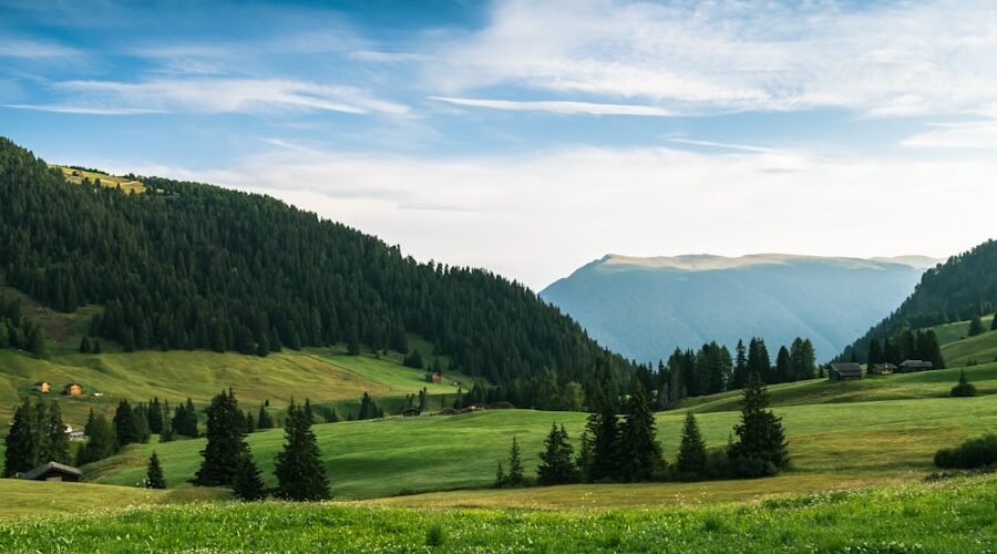
Planning the best time to drive the Gibb River Road requires balancing seasonal weather with remote outback track accessibility. Crossing roughly 660 kilometres through Western Australia’s rugged Kimberley wilderness, this legendary unsealed route changes dramatically between the tropical wet and dry seasons. Choosing the right month ensures safe river crossings, open national parks, and comfortable walking temperatures.
Quick Answer
The best time to drive the Gibb River Road is between June and August during the dry season. These months deliver the coolest daytime temperatures (around 30°C), minimal rain, reliable river crossings, and freshly graded gravel surfaces. May offers flowing waterfalls if roads reopen early, while September provides quieter tracks alongside rising heat.
Last checked: September 2026. Dates and figures were verified against official sources.
Key Takeaways
- June to August: Prime travel window offering cool nights, dry tracks, and fully operating stations, but also peak campground crowds.
- May: Full waterfalls and lush scenery, though opening dates depend on wet-season road repairs and swollen river crossings.
- September: Fewer vehicles and quieter gorges, but daily temperatures consistently exceed 36°C across the Kimberley.
- Grading Cycles: Main Roads WA grades the unsealed road 3 to 4 times per dry season, with each full run taking up to two months.
- Wet Season (November to April): Through-travel is closed; heavy monsoon flooding makes dirt tracks impassable and river crossings hazardous.
There is no single travel window that suits every itinerary. Travellers seeking comfortable hiking conditions favour June and July. Photographers chasing thundering waterfalls prefer May, while adventurers wanting open tracks without convoy traffic aim for September. Because the Gibb River Road traverses isolated pastoral country and protected conservation reserves, travel plans must align with seasonal road closures and park openings rather than fixed calendar dates.
Understanding Gibb River Road Seasons and Access
The Gibb River Road spans 660 kilometres from Derby in the west to the Great Northern Highway junction near Kununurra and Wyndham in the east. Most of the route consists of unsealed gravel, shale, and dirt that react immediately to monsoonal rainfall, heavy cattle transport, and tourist vehicle wear. Main Roads Western Australia monitors surface stability, grading progress, and watercourse depths along the highway to determine legal travel status.
Warning: Driving on a closed road is illegal under Western Australian local government regulations and carries on-the-spot fines. A heavy 4WD, raised suspension, or snorkel does not give you permission to bypass official closure barriers, and vehicle insurance policies generally become void on closed tracks.
The Dry Season: Generally May to October
The dry season represents the primary travel window along the Gibb River Road. Monsoon rains abate, humidity drops, and tourism operators open remote station stays and wilderness lodges. While access may extend into early November during dry years, extreme late-season heat makes strenuous bushwalking hazardous.
Road reopening dates vary from year to year. Main Roads WA and local shire crews must wait for swollen floodways to recede before heavy machinery can repair washouts and re-form creek approaches. A dry May does not guarantee that every side track to popular gorges will open at the same time.
The Wet Season: Generally November to April
The Kimberley wet season brings monsoon downpours, severe tropical storms, and localized cyclones. River systems including the Pentecost, Lennard, and Fitzroy swell rapidly, submerging crossings beneath metres of turbulent water. Unsealed surfaces turn into deep mud, making vehicle recovery impossible.
Through-travel on the Gibb River Road is officially closed throughout the wet season. Tourism stations, private campgrounds, and national park facilities close their gates and demount infrastructure ahead of the annual rains. Self-drive travellers visiting Western Australia during these months should remain on sealed sections of the Great Northern Highway instead.
Pro Tip: Gibb River Road status is split across jurisdictions. Check Main Roads WA for the main thoroughfare, the Shire of Derby / West Kimberley and the Shire of Wyndham-East Kimberley for communal feeder roads, and Explore Parks WA for national park side tracks.
Month-by-Month Gibb River Road Breakdown
Conditions along the corridor change every month as water evaporates and temperatures climb. Official long-term climate observations from the Bureau of Meteorology Kimberley Research Station (Station 002014) illustrate the sharp transition from mild mid-winter afternoons to intense pre-wet build-up heat:
| Month | Mean Max Temp | Mean Min Temp | Mean Rain | Typical Road & River Status | Demand Level |
|---|---|---|---|---|---|
| May | 32.8°C | 18.5°C | 5.7 mm | Reopening phase; deep river crossings; grading underway | Low to Moderate |
| June | 30.5°C | 14.8°C | 3.3 mm | Open; reliable river levels; early graded stretches smooth | High |
| July | 30.6°C | 13.9°C | 2.1 mm | Fully open; low river depths; corrugations forming on busy sectors | Peak (School holidays) |
| August | 33.5°C | 16.0°C | 0.8 mm | Open; dry tracks; prominent corrugations; second grade underway | Moderate to High |
| September | 36.4°C | 20.3°C | 3.9 mm | Open; dry riverbeds; reduced waterfall flows; heavy dust | Moderate |
| October | 38.6°C | 23.9°C | 22.8 mm | Open early; heat-induced equipment stress; stations begin packing down | Low |
| Nov to Apr (Wet) | 35.0–38.8°C | 23.5–25.1°C | 63.8–207.9 mm/mo | Closed to through-traffic; major flooding; national parks shut | Closed |
May: High Waterfalls and Opening Uncertainty
May marks the end of monsoonal rains and the return of road access across the Kimberley. Waterfalls such as Dalmanyi (Bell Gorge) and Manning Falls plunge with powerful post-wet volume, and the surrounding ranges remain vibrant green. Visitor numbers are modest compared with the July rush.
The primary drawback of travelling in May is unpredictable access. If late monsoon rains linger into April, river crossings remain impassable and road maintenance crews cannot begin earthworks. Some station stays, including Mount Barnett or Mount Hart, may delay opening until tracks are declared safe.
June and July: Peak Weather and Established Access
June and July provide the best driving and walking conditions of the year. Daytime maximums average an agreeable 30.5°C, humidity remains low, and night temperatures regularly drop below 15°C, making tent camping comfortable. All main river crossings have stabilized, and roadhouses have fuel and supply chains operating smoothly.
This ideal weather makes July the busiest period on the Gibb River Road. The rush coincides with Western Australian and interstate school holidays. Popular camping areas, such as Dulundi (Silent Grove) and Manning Gorge, see full sites and busy walking trails. Bookings for station accommodations like El Questro should be made months in advance.
August: Dependable Conditions as Temperatures Climb
August retains stable, dry weather while offering fewer family travellers once school holidays finish. Road access remains reliable across the entire 660-kilometre corridor. Shaded swimming holes at Galvans Gorge, Adcock Gorge, and Emma Gorge remain deep and clear.
Afternoon temperatures begin to increase steadily during August, reaching averages of 33.5°C. Smaller seasonal creeks stop running, and high vehicle volumes over the previous two months leave severe corrugations on unpaved sectors before secondary grading takes place.
September and October: Solitude and the Pre-Wet Build-Up
September suits self-sufficient 4WD travellers who want to avoid crowded campsites. Tourist traffic thins out significantly, leaving popular swimming holes quiet. Major river crossings like the Pentecost run shallow and present minimal water resistance for high-clearance vehicles.
The trade-off is intense tropical heat. Mean daytime maximums reach 36.4°C in September and 38.6°C in October, with humidity steadily climbing. Strenuous walks across exposed rocky terrain become punishing after mid-morning. By late October, isolated pre-wet thunderstorms start to develop and several commercial wilderness camps close for the summer.
Road Conditions, River Crossings, and Grading Cycles
Surface conditions along the Gibb River Road are dictated by road maintenance schedules and vehicle traffic. Unsealed sections alternate between sharp basalt rock, packed red earth, fine bulldust, and corrugated gravel. Road conditions can change significantly over a matter of weeks as thousands of 4WD tyres compress and washboard the surface.
How Corrugations and Graders Shape the Drive
Main Roads WA typically grades the unsealed Gibb River Road 3 to 4 times per dry-season cycle. A full grading sweep from end to end takes up to two months to complete. The initial grade occurs right after the road opens in late April or May, smoothing out wet-season scouring.
By mid-July, heavy tourist traffic recreates corrugated washboard ruts on high-speed stretches and corner approaches. A secondary winter grade restores the surface during late July and August. Adjusting vehicle tyre pressures downwards is essential to absorb these persistent vibrations and protect vehicle suspension.
Pro Tip: Lower your tyre pressures when transitioning from sealed bitumen to gravel. Dropping tyre pressure to roughly 26–28 psi (adjusted for load and tyre size) softens corrugation shocks, improves grip on loose shale, and sharply reduces puncture risks from sharp Kimberley stones.
River Crossing Depths Throughout the Year
Fording rivers is an integral part of the Gibb River Road experience. The iconic Pentecost River crossing sits against the Cockburn Range near the eastern terminus and spans roughly 60 metres in width. Water depths vary dramatically by month:
- May: Rivers run deep with strong surface current. The Pentecost can measure 60 to 90 centimetres deep, requiring snorkels, radiator blind covers, and careful wading checks before crossing.
- June and July: River flows stabilize to predictable levels. Depths at major crossings usually range from 40 to 50 centimetres over natural stone bases.
- August to October: Water levels drop below 30 centimetres, making crossings straightforward for standard high-clearance four-wheel-drives.
Navigating Crowds: Peak Travel Windows vs Solitude
Crowd density on the Gibb River Road peaks from late June through late July, driven by Australian school holiday calendars. While remote distances prevent the road from feeling congested, popular gorge car parks and fuel roadhouses experience noticeable pressure.
Regional Kimberley events also draw heavy seasonal traffic into gateway towns. The Boab Metals Ord Valley Muster in Kununurra (staged in May) and the Derby Boab Festival (held in July) bring hundreds of touring convoys directly to the start and finish points of the route.
To avoid crowds, plan your journey for early June before school holidays commence, or travel in the second half of August when family travellers return home. If travelling in peak July, begin gorge walks at sunrise to enjoy natural swimming pools before tour groups arrive.
Cost Considerations: Does the Month Make a Difference?
Fuel, vehicle hire, and campground fees remain steady across the dry season rather than experiencing radical month-to-month discounts. What changes between peak and shoulder months is booking availability and flexibility.
Accommodation and Camping Fees
Station accommodations, private wilderness lodges, and national park campgrounds operate on structured rates throughout their open season:
- National Park Camping: DBCA campgrounds, including Dulundi (Silent Grove) and Bandilngan (Windjana Gorge), charge $15 to $20 per adult per night and require online pre-booking via Park Stay WA. A WA Park Pass is also required for vehicle entry to protected conservation parks.
- Private Station Camping: Mount Barnett (Manning Gorge) operates on a first-come, first-served basis, charging $25 per adult for the first night (which includes gorge access) and $15 for subsequent nights.
- Visitor Permits: Visiting El Questro Wilderness Park requires a visitor permit, costing $15 for a day pass or $29 for a week pass.
Remote Fuel and Vehicle Costs
Diesel and unleaded fuel along the Gibb River Road carry remote transport premiums. Roadhouses including Imintji Community Store, Mount Barnett, and El Questro sell fuel at prices typically $0.60 to $1.00 per litre higher than regional town centres. 4WD hire vehicles must be secured months ahead for June and July travel, with many suppliers requiring explicit authorization for unsealed Kimberley tracks.
What to Pack for Each Season
Packing for the Gibb River Road focuses on outback self-sufficiency and handling temperature fluctuations. The vast distance between full mechanical workshops means your vehicle must carry essential spares and communication tools.
Dry-Season Essentials (May to August)
- Layered Clothing: Breathable, sun-protective shirts for 30°C days, paired with warm fleece jumpers and beanies for nights dropping towards 10°C.
- Sturdy Footwear: Grippy, supportive hiking shoes capable of crossing wet, slippery boulders inside gorge creek beds.
- Vehicle Recovery Kit: Rated snatch strap, shackles, air compressor with accurate tyre pressure gauge, tyre deflator, and puncture repair kit.
- Tyre Spares: At least two complete spare wheels on rims, a high-lift or bottle jack, and a solid jacking base plate for soft sand.
- Offline Communications: Satellite communicator (such as a Garmin InReach or ZOLEO), UHF radio, or satellite phone, as standard mobile phones lose coverage outside Derby and Kununurra.
Note: Carry adequate potable water from reliable town or roadhouse taps. Main Roads WA remote driving guidelines advise carrying a minimum of 4 to 5 litres of drinking water per person per day, plus a 2- to 3-day emergency buffer for unexpected mechanical breakdowns. Do not rely on natural gorges as primary drinking water sources.
Late Dry and Build-Up Additions (September to October)
When travelling during the build-up months, adjust your packing to handle punishing heat and intense UV levels:
- Electrolyte Supplements: Oral rehydration salts to combat rapid fluid loss during exposed canyon hikes.
- Heavy-Duty Vehicle Cooling: Inspect coolant hoses, thermostat, and radiator efficiency before departing to prevent engine overheating in 38°C weather.
- Dust Proofing: High-density storage containers and dust sealing for rear drawers and camp kitchens to combat pervasive bulldust.
Essential Road, 4WD, and Water Safety
Safe travel across the Kimberley requires respecting natural hazards and verifying real-time conditions daily.
Check Road Status on Departure Morning
Conditions along the Gibb change overnight due to vehicle wear, localized weather, or maintenance closures. Before packing up camp each morning, check the Main Roads Travel Map and consult roadhouse staff or park rangers regarding track conditions ahead.
Vehicle Selection and Driving Techniques
Tourism Western Australia highlights that the Gibb River Road is suited to true four-wheel-drive vehicles with low-range capability and generous ground clearance. All-wheel-drive (AWD) passenger crossovers lack the clearance and tyre carcass strength needed for deep river stones and sharp shale rock. Maintain steady speeds between 60 and 80 km/h on gravel, slowing down substantially when approaching blind crests, single-lane floodways, and oncoming cattle road trains.
Crocodile Safety in Kimberley Waters
The Kimberley is home to both freshwater crocodiles and dangerous estuarine (saltwater) crocodiles. Saltwater crocodiles inhabit coastal rivers, tidal estuaries, and can travel vast distances inland into freshwater river pools.
According to the Department of Biodiversity, Conservation and Attractions (DBCA), visitors must treat all Kimberley water bodies as potentially crocodile-inhabited unless clearly designated safe by park authorities.
Warning: Never swim in the Pentecost River, lower Durack River, or any tidal crossing. Restrict swimming exclusively to approved inland rock pools located above major waterfall escarpments, such as Dalmanyi (Bell Gorge) or Manning Falls, and always obey local warning signs.
Frequently Asked Questions
What is the best time to drive the Gibb River Road?
June to August is the best period to drive the Gibb River Road. This mid-dry-season window offers comfortable daytime temperatures averaging 30°C, cool sleeping nights, established road grading, and reliably safe river crossings.
Can you drive the Gibb River Road in May?
Yes, you can drive the road in May provided seasonal opening works have finished. Waterfalls flow at their strongest, but exact opening dates depend on wet-season river runoff, meaning travellers must remain flexible.
When is the Gibb River Road closed?
The road is officially closed throughout the tropical wet season, typically from November through April. Heavy rains flood river crossings, submerge floodways, and make unsealed tracks impassable.
Do I need a 4WD for the Gibb River Road?
A high-clearance four-wheel-drive with low-range gearing is essential for completing the full traverse. All-wheel-drive crossovers lack the ground clearance and robust tyre construction required for river stones and corrugations.
How many days should I spend on the Gibb River Road?
Allow at least 10 to 14 days to complete the full 660-kilometre route properly. This duration provides adequate time for side trips to Bell Gorge, Manning Gorge, and El Questro without rushed driving days.
Is it safe to swim in the gorges?
Swimming is safe only in designated inland gorges above natural escarpment barriers. Never swim in tidal river crossings like the Pentecost, and always check official DBCA signage before entering any waterway.
When is the Gibb River Road graded?
Main Roads WA grades the unsealed road 3 to 4 times during each dry season. The first grade occurs in late April or May, with subsequent passes maintaining the track through August.
Is it cheaper to travel in May or September?
Prices for remote fuel, camping permits, and station stays remain consistent throughout the operating season. You may find wider rental vehicle availability in shoulder months, but daily operating costs do not decrease significantly.
Sources
- Main Roads Western Australia: Gibb River Road conditions, opening updates, and seasonal grading schedules.
- Main Roads Western Australia — Regional and Long Distance Driving: Remote-area provisions, communications, and vehicle safety recommendations.
- Bureau of Meteorology: Long-term temperature, rainfall, and climate averages for Kimberley Research Station (Site 002014).
- Main Roads Western Australia Travel Map: Real-time road and floodway alerts.
- Tourism Western Australia: Official route specifications and 4WD vehicle guidance.
- Department of Biodiversity, Conservation and Attractions: Estuarine and freshwater crocodile safety advice.
- Shire of Derby / West Kimberley: Local government unsealed road conditions and seasonal permits.
- Shire of Wyndham-East Kimberley: Eastern Kimberley road condition reports and unsealed road closures.
- Explore Parks WA: National park alerts, gorge opening dates, and facility guidelines.
- Park Stay WA: Official campground booking portal and fee schedules for Kimberley national parks.


[…] For detailed 4WD itinerary advice, read our comprehensive Gibb River Road travel guide. […]